5 best hikes near Asheville in Western NC: Waterfalls, swimming, high elevation
With temperatures slowly rising to the balmy Western North Carolina summer standard, and old favorites reopening to visitors, it's a great time to start planning a hike.
There are countless trails in WNC, from Pisgah to DuPont State Recreational Forest, Hot Springs to Mount Mitchell and beyond. A hiker's dream, of course -- but where do you start?
If you're overwhelmed trying to choose from the area's tantalizing trails, here are five options to consider, with a little something for everyone.
Trombatore Trail
Trombatore Trail is a great alternative to the more populated Bearwallow, with which it shares a parking lot. Both trails are operated by Hendersonville-based nonprofit Conserving Carolina.
According to the Conserving Carolina webpage, the hike features a giant buckeye tree estimated to be more than 150 years old, clear mountain streams that flow into Upper Brush Creek Blue Ridge Pastures, a grassy bald at the end of the trail and more.
The trailhead is on Bearwallow Road, near Fairview. At roughly 5 miles round-trip and with an elevation gain of 1,000 feet, this hike is considered moderate to strenuous, and not an ideal fit for beginning hikers.
More: Mount Mitchell State Park's restaurant reopened by Burnsville couple; What's on the menu?
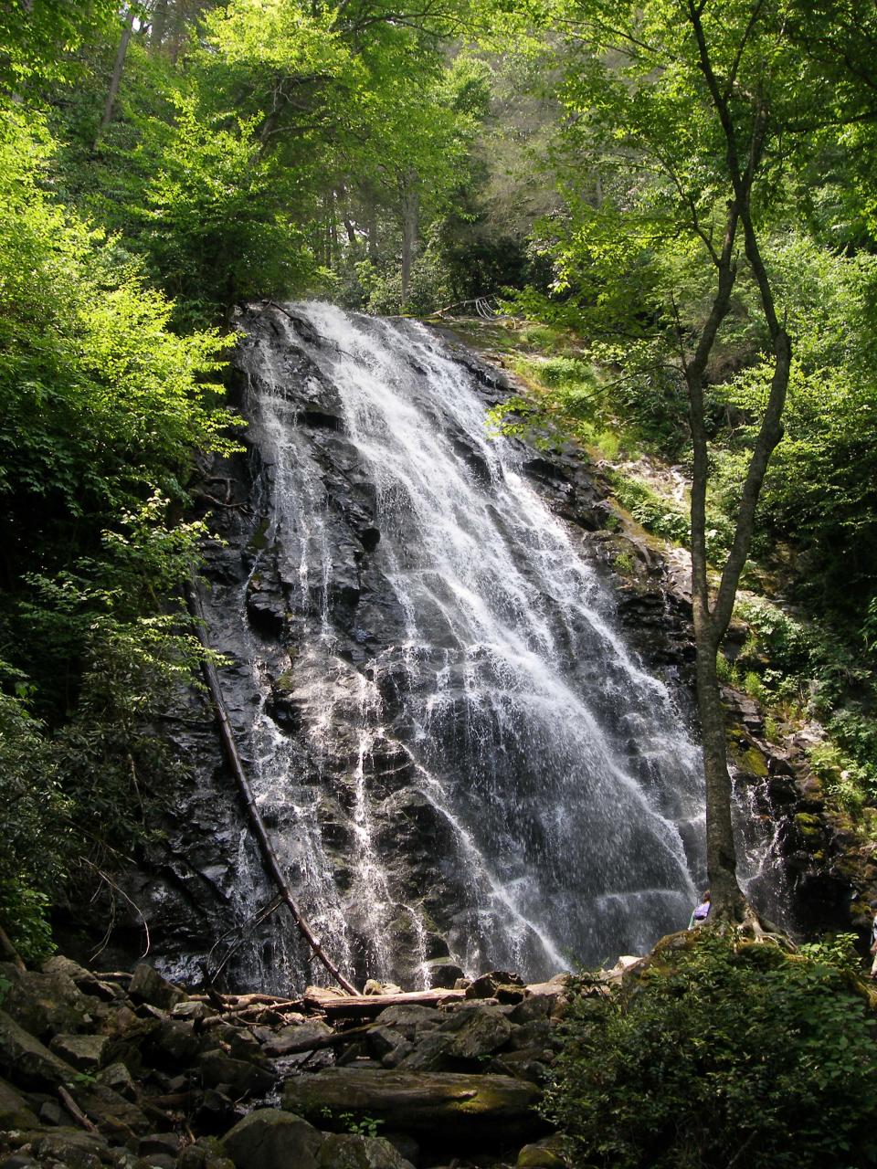
Catawba Falls Ridge Trail

Recently reopened after a two-year closure, Catawba Falls Ridge Trail is safer than ever, and still just as beautiful. With the closure came 580 hand-built stairs and 2.3 miles of new trail. Visitors can hike, view, and swim in pools beneath the falls.
As of May 31, the trail reopened with a 300-foot-high structure featuring the new staircase and 60-foot-high lower falls observation deck. Coming soon to the area is another observation deck at the base of the upper falls, and the opening of the quarter-mile Wildflower Trail named for the many mountain wildflowers lining the path.
The parking area is in Old Fort at the end of Catawba River Road 3 miles from I-40 Exit 73.
If you're planning on visiting Catawba Falls, or any waterfall for that matter, stay safe by being "Waterfall Wise." Rules of thumb to observe include:
Observe all posted signs leading to waterfall areas.
Do not swim or wade upstream near a waterfall.
Watch for slick rocks around waterfalls.
Do not jump off waterfalls or dive into pools.
Do not climb on rocks above waist height.
Watch your children and pets at all times.
Stay on marked trails and observation areas.
More: 'Gateway to Pisgah National Forest,' Catawba Falls reopens with tower for safe viewing
Old Mitchell

The Old Mitchell hike is a classic option among the many choices for hiking at Mount Mitchell. A somewhat challenging trail, the 4-mile loop climbs about 975 feet, with a highest elevation of a staggering 6,700 feet.
The hike begins near the newly opened Mount Mitchell Cafe? & Eatery, so consider fueling up with some artisanal eats before setting out. There is plenty to see along the trail - with the unique high-elevation ecosystem of Mount Mitchell on full display, you can expect to see rocky forest, fragrant fir trees and, depending on the season, fields of wildflowers.
More: New Asheville area hiking, mountain bike trails? Conservation group trying to convert camp
Bridal Veil Falls Loop
Recently named on a list of best hikes in the nation, Bridal Veil Falls loop in DuPont State Forest has an elevation gain of only 109 feet and, of course, views of the stunning, 120-foot cascade of Bridal Veil Falls. Round trip, the trail is 4.6 miles and also passes creeks, horse pastures and Lake Julia.
As an added and intriguing bonus, the trail was featured in two famous movies, "The Hunger Games" and "The Last of the Mohicans."
DuPont Forest is in Henderson and Transylvania counties.
More: Best waterfalls in Western NC: See the tallest, falls with short hikes, swimming holes
Crabtree Falls Hike
About 40 miles northeast of Asheville, the hike to Crabtree Falls is a strenuous one, with 500 feet of elevation gain and a round trip length of about 3 miles.
As the name suggests, the view of Crabtree Falls provided by the hike is the highlight of the strenuous journey. The waterfall is 60 feet high and considered one of the most stunning of the many waterfalls on the parkway. Crabtree Falls Campground is nearby if you'd prefer to make it more than just a day trip, with tent and RV sites available.
Park at Milepost 339.5 near Spruce Pine on the Blue Ridge Parkway.
More: Hiking trails, concert series, scenic train rides: Western NC summer options voted top 10 in US
This article originally appeared on Asheville Citizen Times: 5 best hikes near Asheville, NC: Catawba Falls, Bridal Veil Falls
