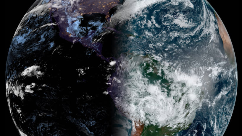
365 days of satellite images show Earth's seasons changing from space (video)

For those of us in the northern hemisphere, the recent chirping of birds and blooming of flowers are welcome signs that spring has arrived — and a new video released by the National Oceanic and Atmospheric Administration (NOAA) shows a stunning glimpse of what this change of seasons looks like from space.
The high-speed video strings together snapshots of our planet's surface taken daily for the past year. These images were taken with the NOAA's GOES-East satellite, which orbits more than 22,000 miles (35,000 kilometers) above Earth's equator. Because the GOES-East satellite orbits at the same speed at which Earth rotates, it constantly observes the same regions, including most of the Americas, the Caribbean and the Atlantic Ocean.
From its vantage point in space, the satellite tracks the edge that separates night and day on Earth. In the new video, you can see how this twilight zone, called the terminator, shifts continually throughout the year. That's because our planet is tilted 23.5 degrees on its axis, which impacts the lengths of days and nights.
March 19 marked the official start to the spring season in the northern hemisphere — the earliest spring has arrived in the U.S. in 128 years. On this day, the sun shone directly above the equator, as the Earth was at a point in its orbit where it is not tilted toward nor away from the sun. Rather, it was at a right angle with respect to the sun, which is why we experienced nearly equal hours of day and night. As such, the terminator at this point is straight, and can be thought of as "slicing" our planet in roughly equal halves.
You can see this instance in the new animation, composed of images clicked at 7:50 a.m. ET (1150 GMT) each day. In the days following the spring equinox, our planet slowly begins shifting toward the sun, which makes the days longer and warmer while the southern hemisphere inches toward winter.
