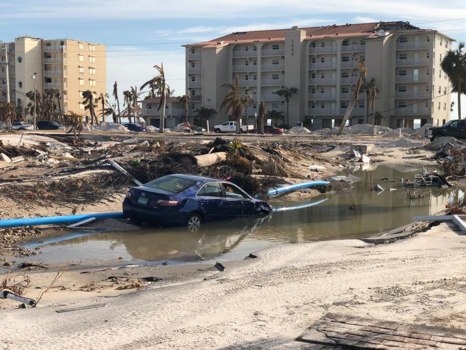
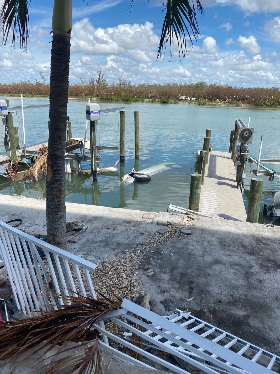
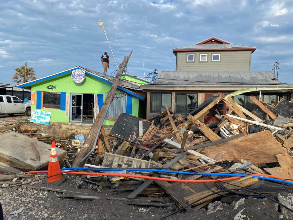
The Gulf of Mexico rose 15 feet in part of Florida as Ian drowned residents, carried away cars and left a trail of rubble, analysis finds

Preliminary analysis of Hurricane Ian’s deadly storm surge suggests the Gulf of Mexico pushed as high as 15 feet above the normally dry ground on Fort Myers Beach, Florida, as it made landfall, the National Hurricane Center said Thursday.
That’s the peak estimate reported by a team of experts with the National Weather Service and other agencies who searched flooded homes and structures in the devastated area for high water marks this week.
The 10-15 feet peak high water levels at Fort Myers Beach puts Ian among some of the higher storm surges in history in the Atlantic basin but well below peak water levels reported in some of the most legendary storms on the northern Gulf Coast.
“Pictures don’t do the destruction justice,” tweeted Jeffry Evans, meteorologist-in-charge of the National Weather Service field office in Houston, also a member of the survey team. “Complete and deadly inundation of the island.”
Such high water helps explain in part why so many of the more than 50 deaths reported in Lee County – at least 30 – were attributed to drowning. Grim reports to the Florida Medical Examiners Commission in the storm’s immediate aftermath described rescuers finding drowning victims underwater, on the beach and in a tree, swept there by the heaving force of the ocean moving inland.

Surveyors measured a water level of 15.5 feet in one home on Fort Myers Beach and a still water mark of 27 inches on the second floor of another home, said Jeff Lindner, meteorologist and director of flood operations with Harris County, Texas. Lindner performed similar surge surveys after Hurricane Michael in Mexico Beach, Florida, in 2018, and Hurricane Laura in Cameron Parish, Louisiana, in 2020.
“The damage was similar with Michael and Ian, but Ian was over a much larger area so a lot more structures were damaged,” Lindner said.
GRAPHICS: Hurricane Ian nears Florida threatening storm surge. Graphics explain the deadly weather event.
EXPLAINER: What is storm surge? Explaining a hurricane's deadliest and most destructive threat
Lindner asked survivors why they stayed, and if anyone could have said anything different to get them to leave.
“One person just flat out said no. She just could not believe the water would come in like that, rush in and rip out walls and tear down the house while they were in it,” Lindner said. “She just could not imagine it.”
In one second-floor condominium, Lindner said the force of the storm surge and waves pushed the contents through the walls and into a back hallway and onto a second-floor balcony.

Some tried to leave as the storm surge rose and were caught in their vehicles. Other stories have emerged of survivors who abandoned their homes and fled to higher ground with neighbors or were rescued at the last minute.
On the day before Ian’s landfall, the hurricane center put the storm surge forecast in the area at 8-12 feet, but by the morning of Sept. 28, the forecast had been increased to 12-18 feet.
Most areas the post-Ian crew surveyed around Fort Myers Beach showed water levels 10-12 feet above the average of the highest high tides recorded in the area, Lindner said.

In 2005, Hurricane Katrina’s storm surge reached 25-28 feet along the Mississippi coast at Bay St. Louis. Long-time residents there were shocked at the height of the water, believing no storm would ever surpass 1969’s Hurricane Camille, which pushed a 24.6-foot storm surge into Pass Christian, just east of Bay St. Louis.
VIDEO: Why storm surge from hurricanes threatens life more than howling winds, experts say
WATCH: FEMA officials warn of dangerous storm surge ahead of Hurricane Ian
In contrast, Hurricane Charley pushed water levels up to 6-7 feet on Sanibel and Estero Islands in August 2004.
Lindner talked to survivors who told him they’d been through Hurricane Charley and didn’t think Ian would be so bad, but Ian was a much larger, slower-moving storm.
In 2017, Hurricane Irma’s peak water levels were reported at 6-10 feet above ground level in an unpopulated area between Cape Sable and Cape Roma on the Southwest Florida coast.
Even Hurricane Donna in 1960 only produced a peak storm surge of 11 feet.
Lindner talked with people trying to understand whether there’s a better way to convince people to evacuate when advised to.

“How do we get people to understand this can happen, and really believe the water can be to their roof, and it’s going to happen in an hour or two,” he said. “It’s going to go from perfectly fine to up to your rooftop in an hour or two and it’s going to be moving very quickly, pushing stuff with debris floating. Then things start to disintegrate and fall apart and wash away.”
Researchers throughout Florida continue to collect watermark information from an array of gauges deployed in the days leading up to Ian. On the state’s east coast, the U.S. Geological Survey reported a high water mark of 10.8 feet in Ponce Inlet.
The hurricane center will gather the information over the coming months and will publish a final assessment in its post-storm report, the center tweeted.
This article originally appeared on USA TODAY: Ian storm surge reached 15 feet in Florida, hurricane center says
Solve the daily Crossword

