As Hurricane Beryl tears through Caribbean, a drone sends back stunning footage
Hurricane Beryl began to weaken on Tuesday but its 155-mph winds and waves were no less devastating or hazardous, perfect conditions for an unmanned drone to explore the fierce seas around the record-breaking hurricane.
Beryl became the earliest Category 5 hurricane on record in the Atlantic, rocketing from a tropical depression to 130 mph winds in just 42.5 hours by Sunday, thanks in part to warmer than normal ocean temperatures. It battered St. Vincent and the Grenadines and Grenada, making landfall on Monday on the island of Carriacou and leaving deaths and destruction in its wake.
As Beryl plowed westward in the Caribbean, a Saildrone Explorer was remotely directed into the northern edge of the storm, more than 100 miles south of Puerto Rico.
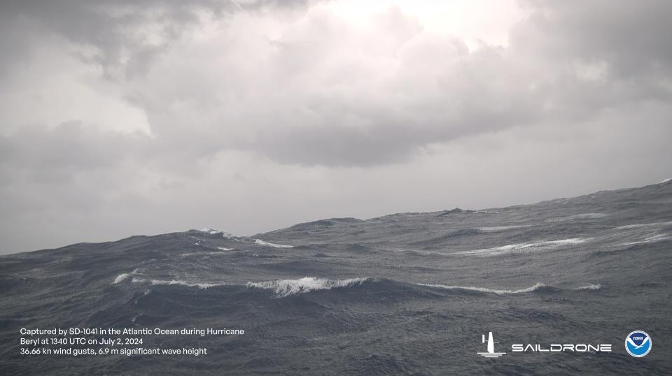
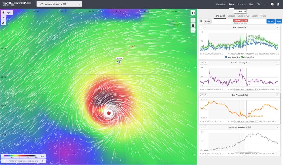
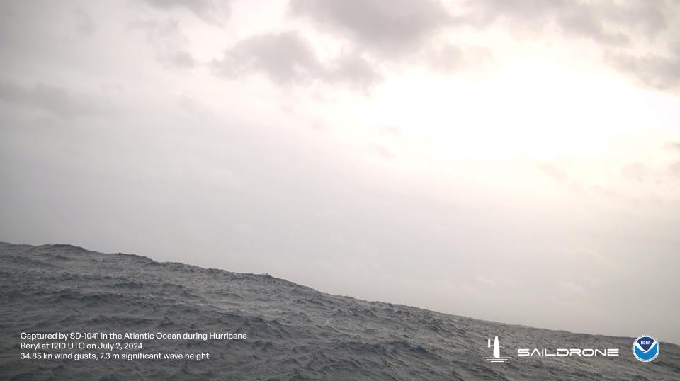
The drone, identified as SD-1041, sent back stunning video and photos of the steep roll of the high seas and the strong winds as it approached Beryl's northern edge Tuesday. It recorded abrupt drops in pressure and wild swings in air temperatures in the rain bands around the storm.
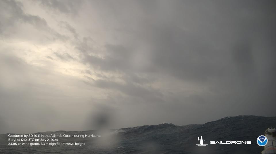
The drone is one of a group of "uncrewed surface vehicles" developed by Saildrone, a company participating in a joint research project with the National Oceanic and Atmospheric Administration to learn more about why hurricanes like Beryl rapidly intensify
By Wednesday, Beryl had weakened to a Category 4 hurricane with 145 mph winds as it continued west toward Jamaica.
The drones used to study this storm and others are among an array of tools developed by NOAA and its partners to unravel the mystery behind why hurricanes like Beryl suddenly explode, growing from timid to terrifying in a matter of hours.
The remote tools that can be directed or dropped into some of the planet's most severe storms are helping researchers better understand conditions in the oceans and atmosphere. The information is being used to help inform and improve the models they use to forecast where a storm will move and how strong it might be.
What conditions did the Saildrone measure in Hurricane Beryl?
The plan for this summer was to have the Saildrone start delivering hurricane monitoring information during the first week of August, the company stated Tuesday. However, because the drone had been deployed in the Caribbean since mid-June, it was drafted early for this mission into Beryl.
The average of the largest third of the waves encountered were nearly 25.6 feet.
Its strongest winds were gusts up to 62 mph and sustained winds of 50 mph.
The lowest pressure was 1009.67.
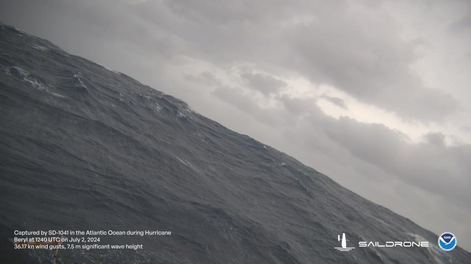
Watch the waves from Saildrone
How big is the drone?
Saildrone Explorers are about 23 feet long. Although the drones typically have a wing "sail" roughly 16 feet tall, the explorers used in hurricanes have "a shorter, more robust 'hurricane wing,'" to withstand the extreme conditions.
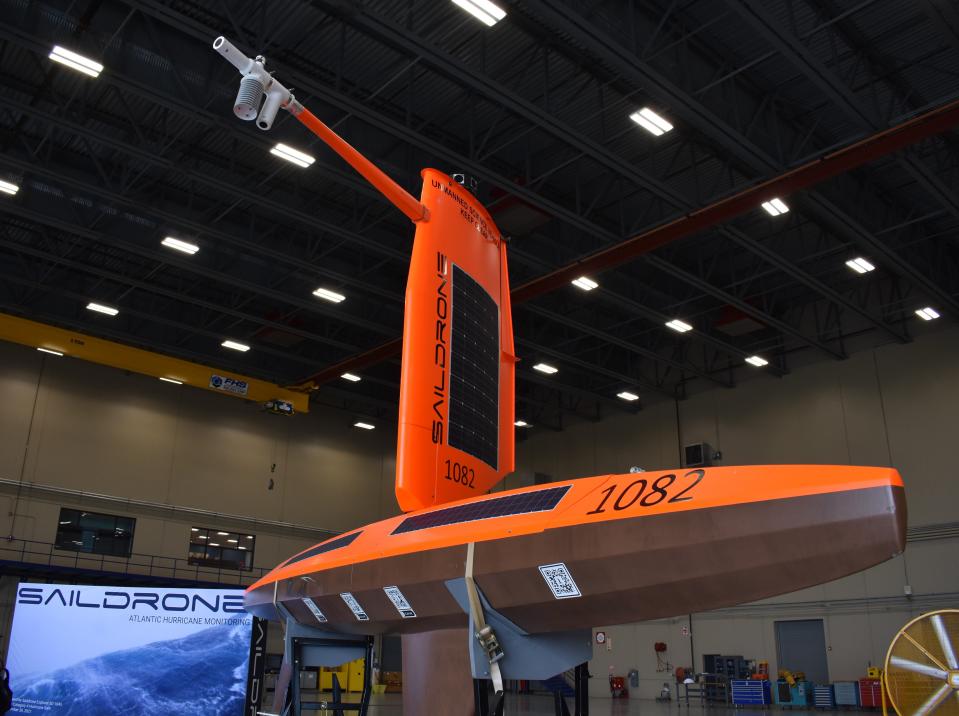
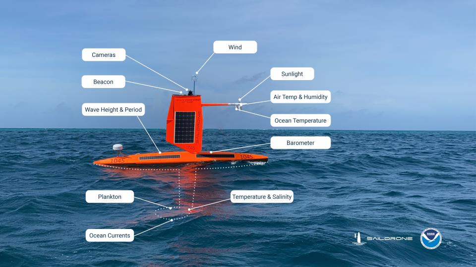
"We are proud to have engineered a vehicle capable of operating in the most extreme weather conditions on earth, to deliver data that can help to advance understanding of these powerful storms and protect our coastal communities,” Saildrone's founder Richard Jenkins said last fall.
Have Saildrone vehicles been used in hurricanes before?
Yes. This summer research is Saildrone-1041's second mission into a hurricane. The unmoored drone was previously deployed during the 2023 hurricane season, and also in the Arctic in 2019 and 2022. Pilots working with NOAA scientists pilot the Saildrones to key locations in and around tropical cyclones.
Inside the eye of a hurricane: How NOAA uses drones to penetrate monster storms
Last September, the company announced the 2024 Guinness Book of World Records would include the feat of another Saildrone – SD-1045. In 2021, that drone captured "the highest wind speed ever recorded by an uncrewed surface vehicle," for measuring winds of 126.4 mph while sailing through the eyewall of Sam, a Category 4 hurricane.
Greg Foltz, a NOAA oceanographer serving as one of the mission's principle investigators, said to see the first Saildrone data continuously streaming in with no interruptions, despite the harsh conditions was "a highlight of my career."
Contributing: Doyle Rice, USA TODAY
Dinah Voyles Pulver covers climate and the environment for USA TODAY. Reach her at [email protected] or @dinahvp.
This article originally appeared on USA TODAY: Hurricane Beryl's destructive seas, from the view of a drone
