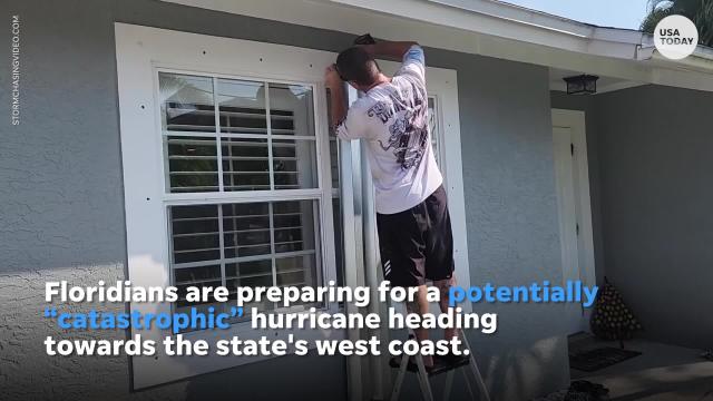
Hurricane Ian's forecast calls for rapid intensification. What does that mean?

They are two of the most feared words associated with hurricane forecasting: rapid intensification. And that's what we're dealing with in Hurricane Ian.
Forecasters warned that the newly formed hurricane was expected to intensify rapidly to Category 3, a major hurricane, as soon as late Monday.
In fact, Ian was forecast to hit Cuba as a major hurricane and then become an even stronger Category 4 with top winds of 140 mph over warm Gulf of Mexico waters before striking Florida along a stretch of coast including the Tampa Bay area by midweek.
What is rapid intensification?
Rapid intensification is a process in which a storm undergoes accelerated growth: The phenomenon is typically defined to be a tropical cyclone (whether a tropical storm or hurricane) intensifying by at least 35 mph in a 24-hour period.
IAN APPROACHES: 'Floridians up and down Gulf Coast' warned as Hurricane Ian strengthens, could reach Category 4
Ian is predicted to fit this definition: Ian had maximum sustained winds of 80 mph on Monday. But the storm's winds were forecast to approach 140 mph by late Tuesday.
"Intensification is predicted on Monday, when Ian will be passing by the Cayman Islands and approaching western Cuba," wrote meteorologists Jeff Masters and Bob Henson on the Yale Climate Connections website. "Crossing Cuba is likely to interrupt the intensification process only briefly, as the few hours Ian spends over Cuba will not significantly disrupt its core.
"Ian is likely to resume intensification over the warm waters of the southeastern Gulf of Mexico on Tuesday," they wrote.

What causes rapid intensification?
"Rapid intensification occurs when a tropical storm or hurricane encounters an extremely conducive environment," Colorado State University hurricane researcher Phil Klotzbach said. "Typically, this environment consists of very warm water, low vertical wind shear and high levels of midlevel moisture."
COASTAL LIVING: Climate change makes living at the coast riskier. But more people keep coming.
Such sudden spikes have been the hallmark of history’s most fearsome hurricanes, Ken Graham, former director of the National Hurricane Center and now director of the National Weather Service, told USA TODAY earlier this year. Out of the nine hurricanes with winds of 150 mph or greater that struck the U.S. mainland over 103 years, all but one saw the explosion of force and power known as rapid intensification.
Is there a climate change connection?
Masters, a former hurricane hunter meteorologist at the National Oceanic and Atmospheric Administration and founder of the Weather Underground, told USA TODAY that global warming is having consequences. "Climate change is causing more rapid intensification of Atlantic hurricanes," he said.
WHA IS THE SAFFIR-SIMPSON HURRICANE WIND SPEED SCALE? Breaking down how we classify hurricanes.
At a recent tropical weather conference, Klotzbach said that while warming sea-surface temperatures aren’t the sole driver of rapid increases in intensity, they do tend to load the dice toward extreme high-end storms.
Contributing: Dinah Voyles Pulver, USA TODAY; The Associated Press
This article originally appeared on USA TODAY: Hurricane Ian to undergo rapid intensification. What that means.