Invest 91L likely to bring heavy rain, impacts to Louisiana next week

BATON ROUGE, La. (BRPROUD) — After watching several disturbances in the Atlantic over the past week with low tropical development chances, there are a few areas of interest that look to have a chance of becoming named storms.
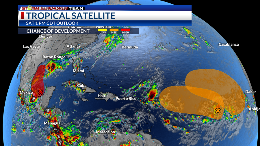
One disturbance, Invest 91L, is located in the Gulf of Mexico, while two other tropical waves are in the Central and Eastern Atlantic.
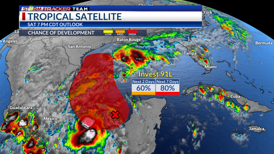
Invest 91L in the Southwestern Gulf will have to be watched closely for interests in Texas and Louisiana as this could become our next named storm. The system could bring heavy rainfall and a threat for flooding to the Gulf Coast. Francine is the next name on the list.

Invest 91L
An area of low pressure has emerged off the Yucatan Peninsula over the Bay of Campeche, associated with showers and storms that are still disorganized. With warm waters and relatively low wind shear over the Western Gulf, conditions look to be favorable for some development where a tropical depression is likely by early to mid-week.
There is a medium chance (60%) for tropical development over the next two days and a high chance (80%) over the next seven days.

There are still a lot of questions with this system. Most model guidance moves the low to the north while hugging the coastline, then possibly up to the Texas-Louisiana border. Too much land interaction may limit any intensification and keep the system sloppy. Meanwhile, if most of the system manages to stay over water, that could favor a more organized storm.

It is too early to nail down an exact track and intensity at this time. Regardless, this will likely bring more rounds of heavy rain to the Gulf Coast over mid-week as tropical moisture pulls northward.
Sunday through most of Monday looks mostly dry for Southeast Louisiana. Rain chances begin to increase on Tuesday with the heaviest rain and potential tropical impacts moving in Wednesday to Thursday. Through Friday evening, around two to four inches of rain may be possible with locally higher amounts.

It is important at this time to keep an eye on the forecast and its updates. Meanwhile, make sure your storm ready kit is prepared with all necessaries and that you have a plan ready, should you need it.

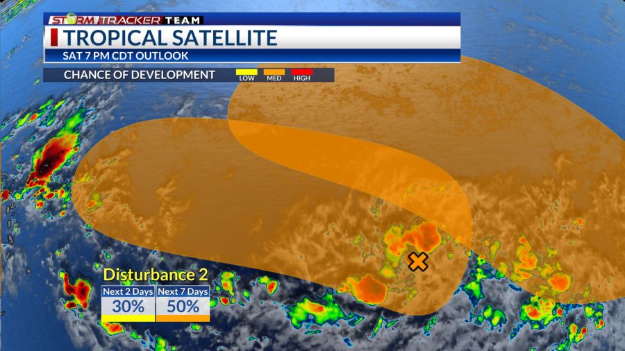
Central Tropical Atlantic Disturbance
A broad area of low pressure continues to produce showers and storms that are beginning to show signs of organization. The system will move very slowly to the west-northwest over the next couple days where gradual development could occur with a tropical depression possibly forming by early next week. There is a medium chance of development (50%) over the next seven days.

Eastern Tropical Atlantic Disturbance
A tropical wave with low pressure has disorganized showers and storms east-southeast of the Cabo Verde Islands. The wave may interact with another tropical wave moving off the coast of Africa next week and some gradual development may be possible. There is a medium chance of development (40%) over the next seven days.

Latest News
Copyright 2024 Nexstar Media, Inc. All rights reserved. This material may not be published, broadcast, rewritten, or redistributed.
For the latest news, weather, sports, and streaming video, head to BRProud.com.
Solve the daily Crossword

