Powder keg storm Hurricane Idalia leaves a trail of destruction. Its fuse was lit by climate change

Earlier this week Idalia was merely a tropical storm, but unnaturally warmed water near America's southeastern coast helped rear it into a record-breaking hurricane flooding Florida and Georgia. Experts agree that excessive heat from climate change, primarily caused by burning ossil fuels, contributed to this result, apparently super-charging the tropical storm. According to NBC News, two people have died, both from car crashes in the storm. Idalia was later downgraded back to a tropical storm Wednesday afternoon.
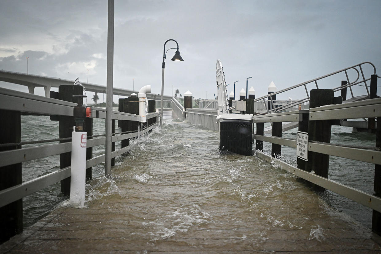
Idalia fluctuated from being a Category 3 and a Category 4 storm throughout Wednesday, according to the South Florida Sun-Sentinel. It made landfall at approximately 7:45 AM local time at the corner of Florida's Big Bend region and by 11 AM had reached Georgia, pummeling through the region southeast of Tallahassee with winds reaching 90 mph. Citrus County Sheriff Mike Prendergast told CNN that "where I'm standing right now could potentially be under 6 feet of water by the time we get the high tide" and predicted "while the hurricane made landfall several hours ago … its affects are going to play out for a long time to come." CNN also reports that bridges connecting Florida islands to the mainland have become inaccessible and that the strong winds have been accompanied by floods and tornadoes.
In the past, a tropical storm like Idalia would often lose power as it reached land. Instead, the water in and around the Florida Keys was so hot that it was literally equivalent to hot tub temperatures, helping to supercharge the tropical storm when it could have otherwise lost strength.
As Reuters reports, there is evidence that the warmer ocean is also slowing down the storm, meaning that it will linger for longer over impacted areas. Because the ocean absorbs 90% of the warming caused by greenhouse gas emissions, that warmer water made Idalia's winds stronger and the storm overall more intense. Indeed, instead of starting in June — as had been the case before temperatures rose to 1.1oC above the pre-industrial average — the hurricane season has been pushed forward to May.

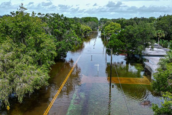
An aerial view shows a flooded street in New Port Richey, Florida, on August 30, 2023, after Hurricane Idalia made landfall. (MIGUEL J. RODRIGUEZ CARRILLO/AFP via Getty Images)
All of this is being acutely felt in the ocean waters near Florida, and all of it is impacting the southeastern United States' experience during Hurricane Idalia.
The ocean water "is absurdly warm and to see those values over the entire northeast Gulf is surreal," University of Miami hurricane researcher Brian McNoldy told the Associated Press (AP).
"It's 88, 89 degrees (31, 32 degrees Celsius) over where the storm's going to be tracking, so that's effectively rocket fuel for the storm," Colorado State University hurricane researcher Phil Klotzbach yold the AP. "It's basically all systems go for the storm to intensify."
Want more health and science stories in your inbox? Subscribe to Salon's weekly newsletter The Vulgar Scientist.
Klotzbach — who co-authored a 2022 study in the scientific journal Geophysical Research Letters on how the annual average of storms that increase their wind speed in one day by more than 57 mph has increased from less than 20 in the early 1990s to more than 30 since the early 2010s — told The Washington Post that he attributed this phenomenon in large part to climate change.
"It's hard to say how much of the increase in rapid intensification is due to human-caused climate change. But, I'd say that it has likely contributed to the increase in these high-end rapid intensification events," Klotzbach told the Post in an email. "I think this makes sense given what we expect with climate change. That is, that climate change tends to shift the [extremes]."
Climate change is not the only variable intensifying this particular hurricane. By sheer astronomical bad luck, a rare blue supermoon is coinciding on Wednesday which will increase the gravitational pull on the oceans and thereby make the tides even higher, increasing their range and worsening flooding in Florida, Georgia and South Carolina.
Yet the most significant variable in exacerbating this storm appears to still be climate change, as indicated in a study published last week in the scientific journal Nature. Researchers studying rapid intensification events (RI) between 1980 and 2020 found that these occurrences — which usually lead to worse hurricane and cyclone outcomes for coastal residents — tripled for "offshore areas within 400 km [250 miles] of the coastline."
"Climate models show that global ocean warming has enhanced such changes," the authors say. "This work yields an important finding that an increasing threat of RI in coastal regions has occurred in the preceding decades, which may continue under a future warming climate."
Although RI events are notoriously unpredictable, experts certainly see climate change as warming the oceans to an extent that is dangerous when it comes to possible future storms.
"Rapid intensification is historically hard to predict and the numerical guidance often struggles to capture it adequately," Jim Kossin, a hurricane expert at the University of Wisconsin-Madison and the nonprofit First Street Foundation, told Axios in an email. He later added that "on the other hand, we have been seeing more and more explosive intensification over the past 5-to-10 years, and this certainly must be making everyone nervous."
These storms are also expected to exacerbate sea level rise, as the storms coincide with other variables that ultimately jeopardize communities that are at or close to sea level.
"There is a fair bit of resilience in coastal regions because of tides and storms; it is when all factors coincide that risk of inundation and erosion etc is greatest," Dr. Kevin E. Trenberth, a distinguished scholar at the National Center for Atmospheric Research, said earlier this month. "Modeling of ice sheets is primitive and uncertain. The West Antarctic ice is grounded below sea level and is vulnerable and could collapse at some point. But sea level rise is relentless. Because of uncertainties it is generally best not to say what [sea level rise] is at a particular date but rather that the amount in question occurs between these dates... It is not a matter of if, but when."
Read more
about climate change