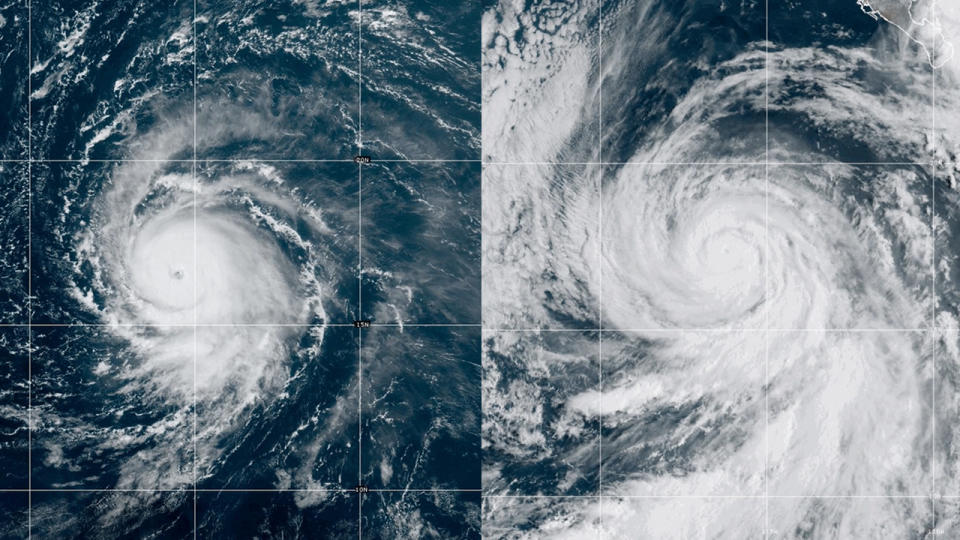
Powerful Hurricane Jova spotted from space (video)

The Northern Hemisphere's most powerful hurricane of 2023 so far has emerged above the warm waters of the Pacific Ocean, taking shape in less than 48 hours.
The good news is that this storm, called Jova, is not heading to the coast. At the same time, Hurricane Lee has formed in the Atlantic, and it's predicted to skirt some Caribbean islands later this week, bringing rough weather.
The mind-boggling intensification of Jova has prompted meteorologists to comment on X, formerly known as Twitter, as they shared sequences of satellite images showing the monster storm swirling above the ocean.
"Watch Jova go from a tropical depression to a Category 5 hurricane in just over 48 hours," Weather Channel senior meteorologist Jonathan Erdman said in a post on X on Thursday (Sept. 7), sharing a video of the storm with a clearly defined eye form from an innocent-looking clump of clouds. "It's the first [eastern Pacific] Category 5 hurricane in almost five years."
Related: Climate 'points of no return' may be much closer than we thought

The National Weather Service San Diego said Jova was the fastest-intensifying hurricane in the eastern Pacific since 2015's Hurricane Patricia, having grown from a Category 1 to a Category 5 maelstrom in about 18 hours.
Jova formed from an area of low pressure off the western coast of Mexico on Wednesday (Sept. 6). By Thursday, it was packing sustained winds of at least 157 mph (252 kph). Fortunately, the hurricane is moving in the northwestern direction and poses no immediate threat to inhabited areas. According to AccuWeather, the hurricane will bring rough surf and rip currents to the coast of Mexico and Southern California.
Related stories:
— Removing carbon from Earth's atmosphere may not 'fix' climate change
— Earth is getting hotter at a faster rate despite pledges of government action
— 10 devastating signs of climate change satellites can see from space
On the other side of the American continent, Hurricane Lee has sprung up in the eastern Caribbean Sea and threatens to grow into a potentially devastating Category 5 hurricane by the weekend. Unlike Jova, whose path is rather harmless, Lee is expected to impact multiple communities. For example, forecasts have it bringing intense rainfall, sea swell and strong winds to Anguilla, Antigua, Bermuda, Bahamas, Puerto Rico and the British and U.S. Virgin Islands.
The Atlantic hurricane season, set to peak on Sept. 10, has so far produced two major hurricanes, Franklin and Idalia, both of which reached peak intensities as Category 4 storms. In the Pacific, the disintegrating Hurricane Hillary was the first tropical storm in 80 years to hit Southern California.
