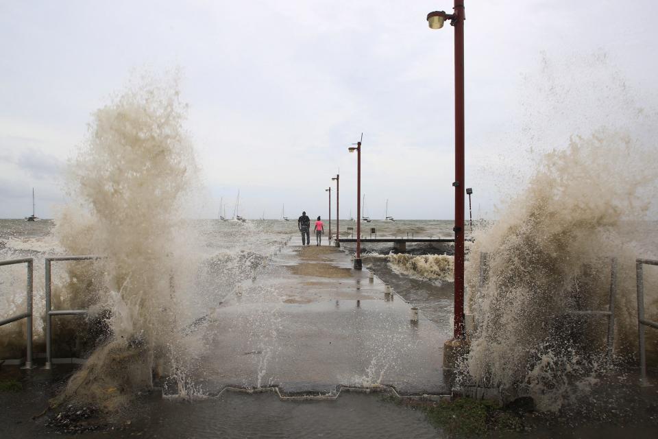
Record-smashing Hurricane Beryl may be an 'ominous' sign of what's to come
Hurricane Beryl's explosive and record-smashing start to the 2024 season is a worrisome sign for the remainder of the year, weather experts said Monday.
It's a "hugely ominous start to the season," said chief science officer Steve Bowen of Gallagher Re, a reinsurance firm, on X, formerly Twitter. "If you were doubtful of the seasonal hyperactive forecasts, this should be a wake-up call."
"Buckle up. It could be a challenging few months ahead," he said. "This is a massive warning sign for the rest of the season."
Colorado State University hurricane researcher Phil Klotzbach told USA TODAY that early storms aren't necessarily an indicator of what's to come. But Beryl's unprecedented numbers tell a different story this year.
"Normally, early season activity doesn't have much of a bearing on the rest of the season's activity, but when that activity occurs in the tropics and east of (about) 75 degrees W, it tends to be a harbinger of a very busy season," Klotzbach said.
"Unfortunately, Beryl is breaking records that were set in 1933 and 2005 – two of the busiest Atlantic hurricane seasons on record," Klotzbach said.
Meteorologist Jeff Berardelli of WFLA-TV in Tampa also noted that Beryl is now the strongest hurricane on record this early in the season.
"It’s showing us exactly what hurricane season 2024 is going to be," he said. "Prepare now, just in case," he warned on X.
A slow start to hurricane season that didn't last
The 2024 hurricane season seemed to be off to a slow start at the beginning of June, but now it's making up for the brief lull when people wondered whether the preseason chatter about an above-average season may have been premature.
Beryl – a major hurricane with sustained winds of 150 mph and higher gusts – tore across the southerly end of the Windward Islands on Monday, leaving potentially catastrophic damage in its wake on the Grenadine Islands and Grenada. Its meteoric increase in wind speeds broke records over the weekend.
"It's very impressive how many different superlatives there are for Beryl," Sam Lillo, a meteorologist and software engineer for DTN Weather, told USA TODAY on Sunday. The first hurricane on record to reach major hurricane status before July 1, Beryl also surprised forecasters with its early season arrival, so far south in the Atlantic.
On Sunday evening, a system that had been brewing for a couple of days in the northwestern Caribbean and southwestern Gulf of Mexico became Tropical Storm Chris as it approached a forecast landfall on the Mexican coast That puts the season weeks ahead of normal. In a typical year, the season doesn't produce three named storms until Aug. 3.
A third system is moving westward off to the east of Beryl and is likely to become a tropical storm later this week, the hurricane center said.

Just how unusual is Beryl?
Beryl startled forecasters by its location, timing and incredible burst of activity that took it from a tropical depression with 35-mph winds to a major hurricane with 115-mph winds in less than 42 hours.
Only six other Atlantic storms on record have increased from a tropical depression to a major hurricane in a similar time frame, Lillo said. All of those occurred after Sept. 1.
"By June, we are starting to see September-type storms," Lillo said.
Search the National Oceanic and Atmospheric Administration's historical hurricane tracker for Category 4 and 5 hurricanes before July 1 ? and you won't find any.
Beryl was the first by more than a week, breaking a record set when Hurricane Dennis became a Category 4 storm on July 8, 2005. At one point, Hurricane Audrey in 1957 had been listed as a Category 4 on June 27, but in a reanalysis, NOAA concluded Audrey only reached Category 3 strength.
Beryl's dramatic rapid intensification – from a tropical depression to 130 mph winds in 48 hours – would be amazing for any time of year, Lillo said. "To develop and intensify to a Category 4 at that latitude, that's really exceptional. And to have this happen way out east of the islands, that's amazing."
In a search of the hurricane center's extensive database, Lillo could only find three other storms known to have strengthened from a tropical depression to Category 4 in less than 48 hours: Keith, starting on Sept. 30, 2000, Wilma in October 2005 and Delta in 2020.
Hurricane Wilma's winds went from 70 mph to 175 mph in 24 hours from Oct. 18 to Oct.19, and it still holds the record for the most intense Atlantic hurricane ever recorded, based on its minimum pressure of 916 millibars.
The hurricane center does not expect Beryl to reach Category 5 strength, but if it did, that would also set an early-season record. The earliest known Category 5 was Emily on July 17, 2005.
Stronger hurricanes early in the season are typically more common in the northwestern Caribbean or Gulf of Mexico, while storms that typically flare up in the monsoons that move off the African coast are more common later in the season.
How did Beryl manage such a rapid intensification?
Several key factors working together, Lillo said.
? Unusually warm ocean waters.
? Its compact, small size allows storms to change intensities faster.
? Weaker winds over the Atlantic that allowed the hurricane to spin up high, cloud tops that help form the heat engine that gives a hurricane its strength and high winds.
Dinah Voyles Pulver covers climate and the environment for USA TODAY. Reach her at [email protected] or @dinahvp.
This article originally appeared on USA TODAY: Hurricane Beryl may be an 'ominous' sign of what's to come
