Strong storms moving through Asheville area, WNC May 8: Power outages, flooding possible

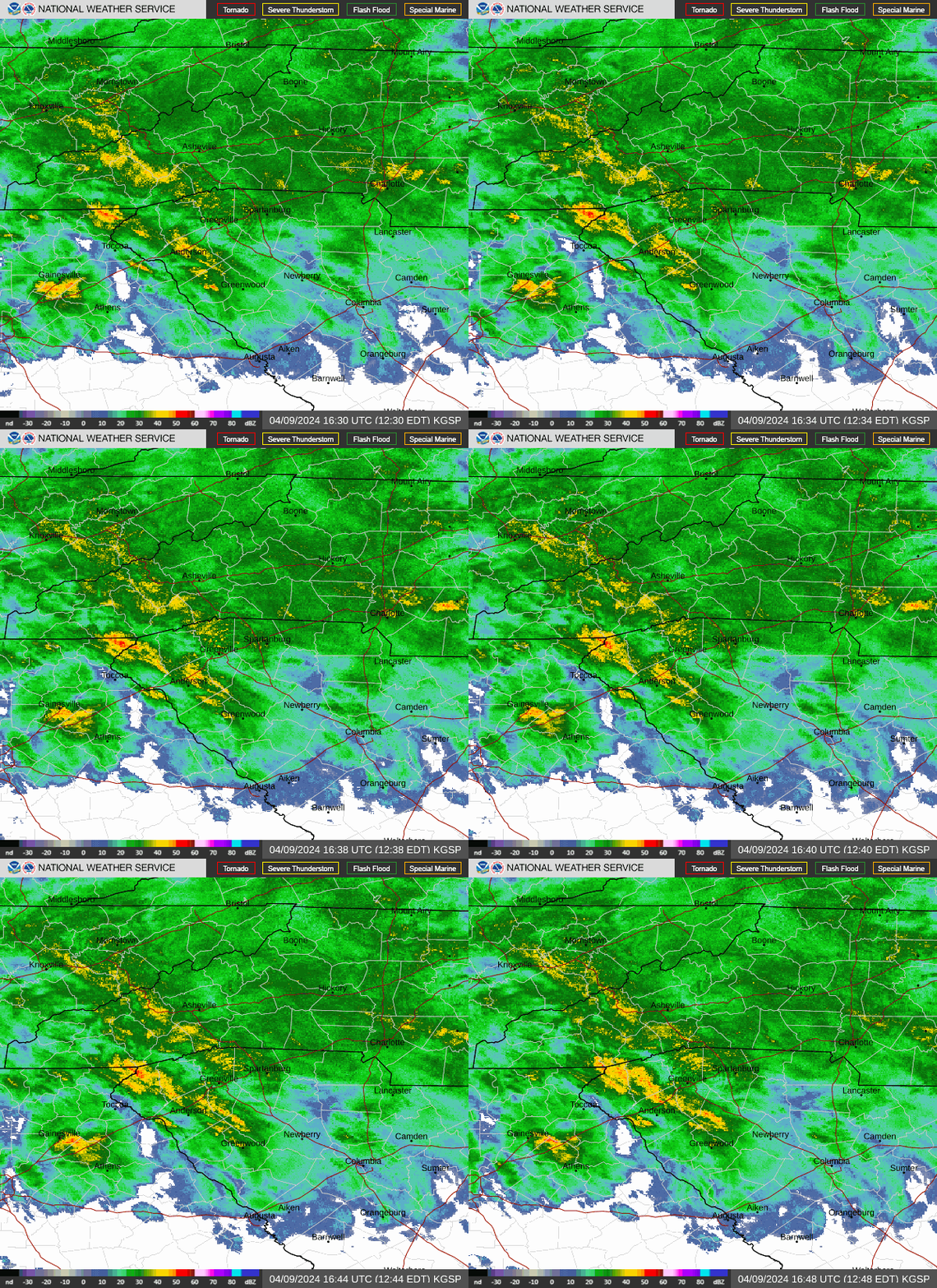
This afternoon, Western North Carolina was beginning to see the effects of wild weather slated to last for seven days. A severe thunderstorm warning ended at 2 p.m., leaving over 2,000 Duke Energy customers in Buncombe County without power in the aftermath of the storm.
The May 8 severe thunderstorm warning issued by the National Weather Service affected northeastern Buncombe and southern Yancey counties. Radar showed the storm could bring tennis ball-sized hail and 70 mph wind gusts. A severe thunderstorm watch was also in effect until 4 p.m.
The report urged residents of the areas to move to interior rooms on lowest floors of their residences. Meteorologists warned against outdoor activities during the time the warning is in effect, as people and animals outside during the storm could be injured by the weather.
The warning also said hail damage to roofs, siding, windows and vehicles was possible, as well as considerable tree damage. Winds were strong enough to cause damage to mobile homes, roofs and outbuildings.
So quickly did the storms materialize that meteorologists for the NWS told the Citizen Times at 2:45 p.m. that due to the high volume of calls, further information would not be available until later in the afternoon.
As of 2 p.m., 981 Duke Energy customers in Buncombe County were without power, according to the Duke Energy power outage webpage. By 3 p.m., the number rose to 2,099 but dropped to fewer than 900 by 5:15 p.m..
A look at today's weather
A hazardous weather outlook May 8 for northeast Georgia, Piedmont and Western North Carolina and Upstate South Carolina detailed seven days of turbulent weather. The report said that thunderstorms have likely passed for now, with most of the daytime inclement weather predicted before 4 p.m.
It's still possible things will become livelier overnight, however, with predictions of showers and thunderstorms. Chance of precipitation tonight is at 80%, according to the weather service, with rainfall amounts between a quarter and half of an inch possible.
Chris Horne, a meteorologist at the NWS, said that while it wasn't yet certain, it seemed most likely that tonight's storms would not be as robust as the ones Buncombe saw during the day May 8.
"The real strong stuff has all moved into the south of Asheville for the most part, and that's where the threat is going to remain into the evening hours," Horne said. "We have this pretty active pattern, through tomorrow. So, there's kind of waves of storms expected through that period."
He added that there is a chance of severe thunderstorms around midnight May 8, and the potential for more storms Thursday morning, May 9.
Possibility of tornadoes in Asheville area, damaging winds
The NWS hazardous weather outlook said that one of the main concerns for the next few days was high winds. The threat for damaging wind gusts is active from today into Thursday morning.
The outlook also mentioned the possibility of brief, isolated tornados, mainly today, May 8. Horne said that they'd seen some tornado activity during the storm, but nothing that Buncombe residents should be concerned about.
As of around 3:30 p.m., a tornado warning was active in the Shelby area.
"Storms that moved across Buncombe County and neighboring counties down into lower terrain, one of the storms strengthened to where it has tornado rotation," Horne said. "So, that's where the isolated tornado risk exists along that corridor this afternoon."
What to know about hail and flash flooding
The other main threat mentioned by the NWS in the report beyond dangerous winds was from large hail. Hailstones produced by the storms could reach sizes larger than golf balls, with the potential to damage roofs, siding, windows and vehicles.
Luckily, Horne said that the risk for hail in the area has likely passed for the afternoon.
"There may be some storms producing small hail here and there in the mountains, but everything's always been worked over," Horne said. "It's kind of done for the afternoon -- the really severe storms and big, hail-producing storms for the mountains."
At 2:34 p.m. May 8, the NWS issued a flood advisory for Buncombe, Henderson, McDowell and Rutherford counties effective until 8:30 p.m. this evening. The areas of greatest concern were the Hickory Nut Gorge from Gerton to Edneyville to Chimney Rock to Lake Lure. NWS said that anyone near streams, including the Rocky Broad River, should seek higher ground in case rapid rises overwhelm adjacent low-lying areas.
The main impact is expected to be "nuisance flooding" of low-lying areas adjacent to streams and other poor-drainage areas, the weather service said. This includes farmland, parks, greenways, boat-access areas, golf courses, underpasses and parking lots. Some isolated, shallow flows over roadways is possible.
Iris Seaton is the trending news reporter for the Asheville Citizen Times, part of the USA TODAY Network. Reach her at [email protected].
This article originally appeared on Asheville Citizen Times: Severe thunderstorm for Asheville, Buncombe: power outages, flooding