Western US heat wave to roll eastward
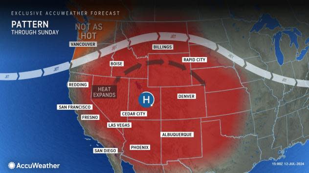
The core of the massive heat dome responsible for multiple all-time record highs in California and Nevada will slowly shift eastward through this weekend and into next week, with the highest temperatures relative to the historical average to be experienced over the Great Basin, Rockies and Plains, AccuWeather meteorologists advise.
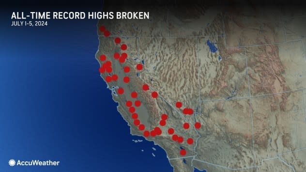
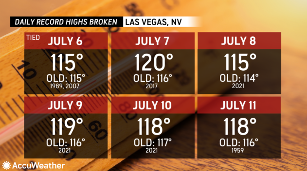
All-time record highs were tied or broken at more than 50 locations in California and Nevada from July 1-5. Among those set were set in Palmdale, California (115 F), Redding, California (119 F), Las Vegas, Nevada (120 F), and Palm Springs, California (124 F). When an all-time high-temperature record is set, it means the location has never experienced a higher temperature since record keeping began. Some records date back to the 1800s.
 |
Many locations also set daily high temperatures on multiple days which highlights the intensity and duration of the heat wave, even in typically hot desert locations.
In some areas, the temperature has been 10-20 degrees above the historical average.
 |
As the center of the large high-pressure area shifts eastward, the extreme heat will continue to ease in the Pacific Coast states and in many of the Nevada and Arizona deserts. Daily temperatures will trend downward, closer to historical averages.
Following high temperatures close to 90 in Los Angeles at midweek, more typical highs in the mid-70s are forecast for Sunday. In Sacramento, California, high temperatures will trend downward from the 110s on Thursday to the low 90s by early next week.
While the temperature trends down in part of the West, they will rise farther to the east in Utah, Idaho, Colorado, Wyoming and New Mexico.
 |
For example, highs in Salt Lake City are forecast to be within a few degrees of 105 on Saturday. The all-time record of 107, reached most recently on July 17, 2022, could be challenged.
Just on the eastern side of the Rockies, Denver reached 102 on Friday setting a new daily record and will continue to experience high temperatures in the low 100s through Sunday and challenging record highs.
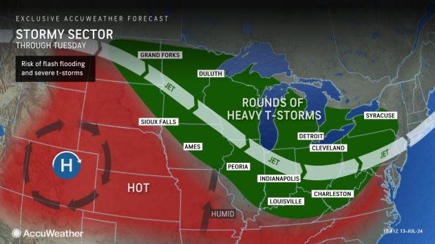
The extreme heat will also expand onto the Great Plains by next week. On Monday, a high about 20 degrees above the historical average of 87 is forecast for Scottsbluff, Nebraska. Kansas City, Missouri, will experience highs near the 100-degree mark on multiple days early next week.
 |
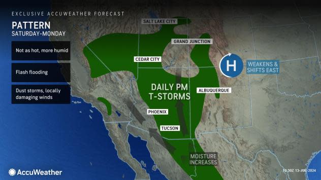
"The change in the orientation of the high-pressure area will allow some moisture that has been setting off thunderstorms in New Mexico and eastern Arizona to expand westward into more of the deserts and the mountains of the Southwest region during the balance of this week and this weekend," AccuWeather Senior Meteorologist Dave Houk said.
The shift will result in higher humidity levels, which will allow thunderstorms to pop up, mainly in the mountains from Arizona and Nevada to California.
 |
"Despite the higher moisture in the air, most of the spotty storms that do erupt associated with the North American monsoon, will bring little rain but lightning strikes and locally gusty winds," Houk said, "The lightning strikes could trigger new wildfires and gusty winds can result in dust storms where little or no rain falls."
As of Wednesday morning, there were more than 70 active large wildfires in the U.S. with the majority scorching land from the Rockies to the Pacific Coast states, according to the National Interagency Fire Center.
In rare cases, enough rain can fall within the core of the thunderstorm to bring a torrential downpour. Where the runoff works into the normally dry stream beds or slow-flowing rivers, a flash flood can occur that picks up considerable debris, such as fallen trees and rocks that may block some secondary roads.
Want next-level safety, ad-free? Unlock advanced, hyperlocal severe weather alerts when you subscribe to Premium+ on the AccuWeather app. AccuWeather Alerts? are prompted by our expert meteorologists who monitor and analyze dangerous weather risks 24/7 to keep you and your family safer.


