Where is La Ni?a? See what the climate troublemaker could mean for your winter
The long-promised La Ni?a climate pattern hasn't yet formed but is still expected to within the next month or so, federal scientists say.
Specifically, the Climate Prediction Center said Thursday that there is a 60% chance that La Ni?a conditions will emerge by the end of November. And once it forms, it is expected to persist through January-March 2025.
Speaking about La Ni?a, climate scientist Michelle L'Heureux told USA TODAY the "onset is delayed ... It has not formed yet." She added the delayed onset could mean a weaker version of La Ni?a, if indeed it does form.
Another forecaster, AccuWeather's Jason Nicholls, agreed, noting, "It still looks like a weak La Ni?a will form over the coming months and should be short lived."
La Nin?a often creates weather patterns that increase hurricane activity in the Atlantic Basin, which if it forms could still affect the tail end of this year's season. It also affects winter weather in the U.S. and around the world.
What is La Ni?a?
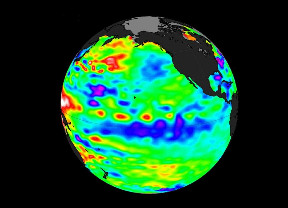
La Ni?a is a natural climate pattern marked by cooler-than-average seawater in the central and eastern Pacific Ocean. When the water cools at least 0.9 degree Fahrenheit below average for three straight months, a La Ni?a is declared.
"While this may sound like a small change in temperature, it can cause significant changes in the weather patterns around the globe," AccuWeather meteorologist Brian Lada said.
It is one of the main drivers of weather in the United States, especially during the late fall, winter and early spring. It's the opposite to the more well-known El Ni?o, which occurs when Pacific Ocean water is at least 0.9 degree warmer than average for three months.

What might La Nin?a bring next winter?
A typical La Nin?a winter in the U.S. brings cold and snow to the Northwest and unusually dry conditions to most of the Southern states, according to the Climate Prediction Center. The Southeast and mid-Atlantic also tend to see higher-than-average temperatures during a La Nin?a winter.
New England and the Upper Midwest into New York tend to see lower-than-average temperatures, the Weather Channel said.
The National Oceanic and Atmospheric Administration will be releasing its official winter forecast Thursday, and L'Heureux said the likely La Nin?a will be a major part of the forecast.
Other forecasters also were watching for La Nin?a: Earlier this week, Japan's weather bureau said that although there were no signs of El Ni?o or La Ni?a phenomena at this moment, characteristics of La Ni?a were approaching.
What is El Ni?o? What is ENSO-Neutral?
El Ni?o is a natural climate pattern in which sea surface temperatures in the central and eastern tropical Pacific Ocean are warmer than average. It occurs, on average, every two to seven years.
Its name means "the little boy," or "Christ child" in Spanish. El Ni?o originally was recognized by fishermen off the coast of South America in the 1600s with the appearance of unusually warm water in the Pacific Ocean around Christmas.
The entire natural climate cycle is officially known as El Ni?o – Southern Oscillation, called ENSO by scientists. The cycle swings between warmer and cooler seawater in a region along the equator in the tropical Pacific. La Ni?a is marked by cooler-than-average ocean water in the region.
When water temperatures are neither unusually warm nor cool, "ENSO-neutral" conditions are declared.
That's what's happening now: "Waters in the eastern and central Pacific Ocean near the equator have remained at near-average temperatures this month," said Weather.com meteorologist Chris Dolce Thursday. That means neither El Ni?o, nor its counterpart La Ni?a, are ongoing.
Contributing: Reuters
This story was updated to add a video.
This article originally appeared on USA TODAY: La Ni?a winter forecast: What weather phenomenon could mean for you
Solve the daily Crossword

